MeteoHuelva.es(@Meteohuelva) 's Twitter Profile Photo

Las lluvias han hecho que las marismas de Doñana hayan cambiado drásticamente respecto a como estaban hace sólo un año.

Aquí tenéis la comparación con imágenes del satélite Sentinel2.

Es sencillamente impresionante.

Vía Copernicus EU
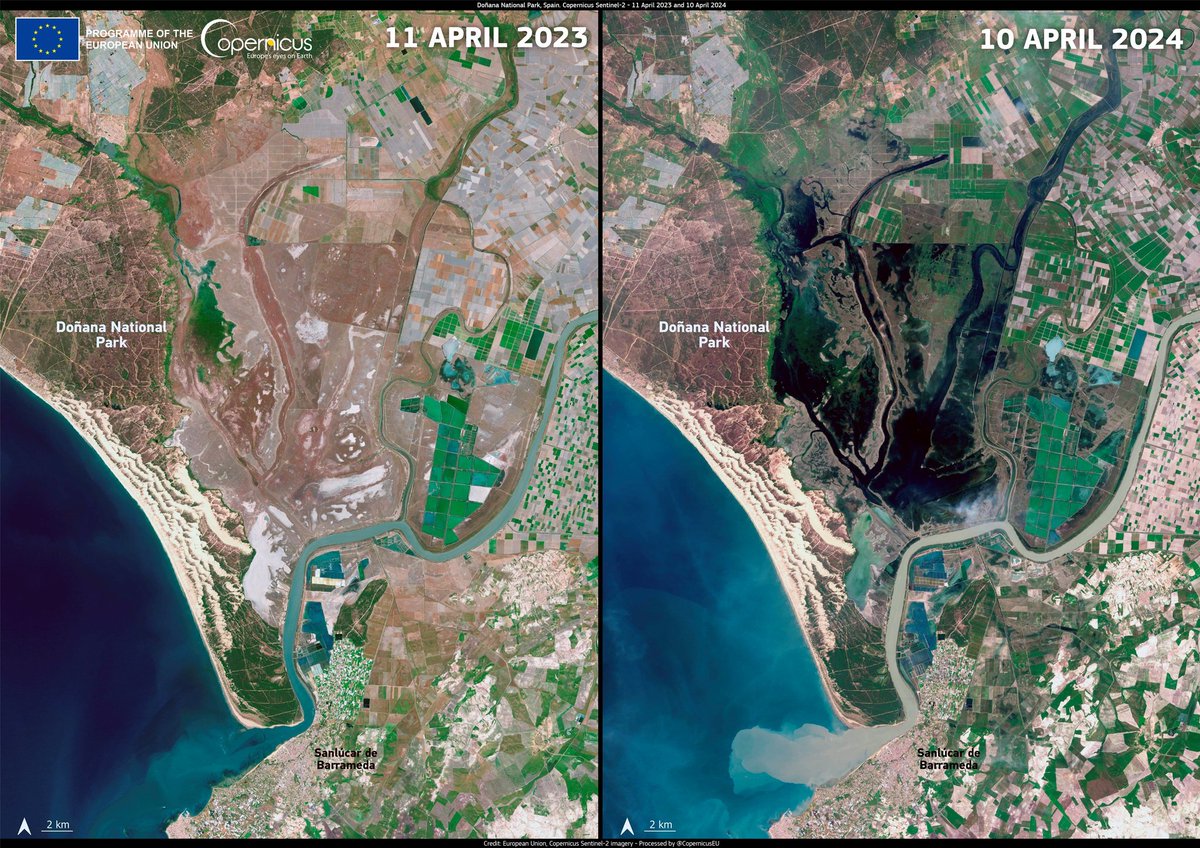
Las lluvias han hecho que las marismas de Doñana hayan cambiado drásticamente respecto a como estaban hace sólo un año.

Aquí tenéis la comparación con imágenes del satélite Sentinel2.

Es sencillamente impresionante.

Vía @CopernicusEU
account_circle
Giulio Betti(@Giulio_Firenze) 's Twitter Profile Photo

La rapida fusione della neve ha causato una piena record del fiume e la rottura di una diga a . Più di 100.000 persone colpite da un'inondazione senza precedenti lungo i 2.400 km del fiume. Di seguito l'animazione che mostra la devastazione in . 1/2

account_circle
European Space Agency(@esa) 's Twitter Profile Photo

Our ESA Earth Observation Φ-lab has released, in partnership with Hugging Face, the first dataset of 'MajorTOM', or the Terrestrial Observation Metaset, the largest community-oriented and machine-learning-ready collection of Copernicus EU images ever published and covering over 50%
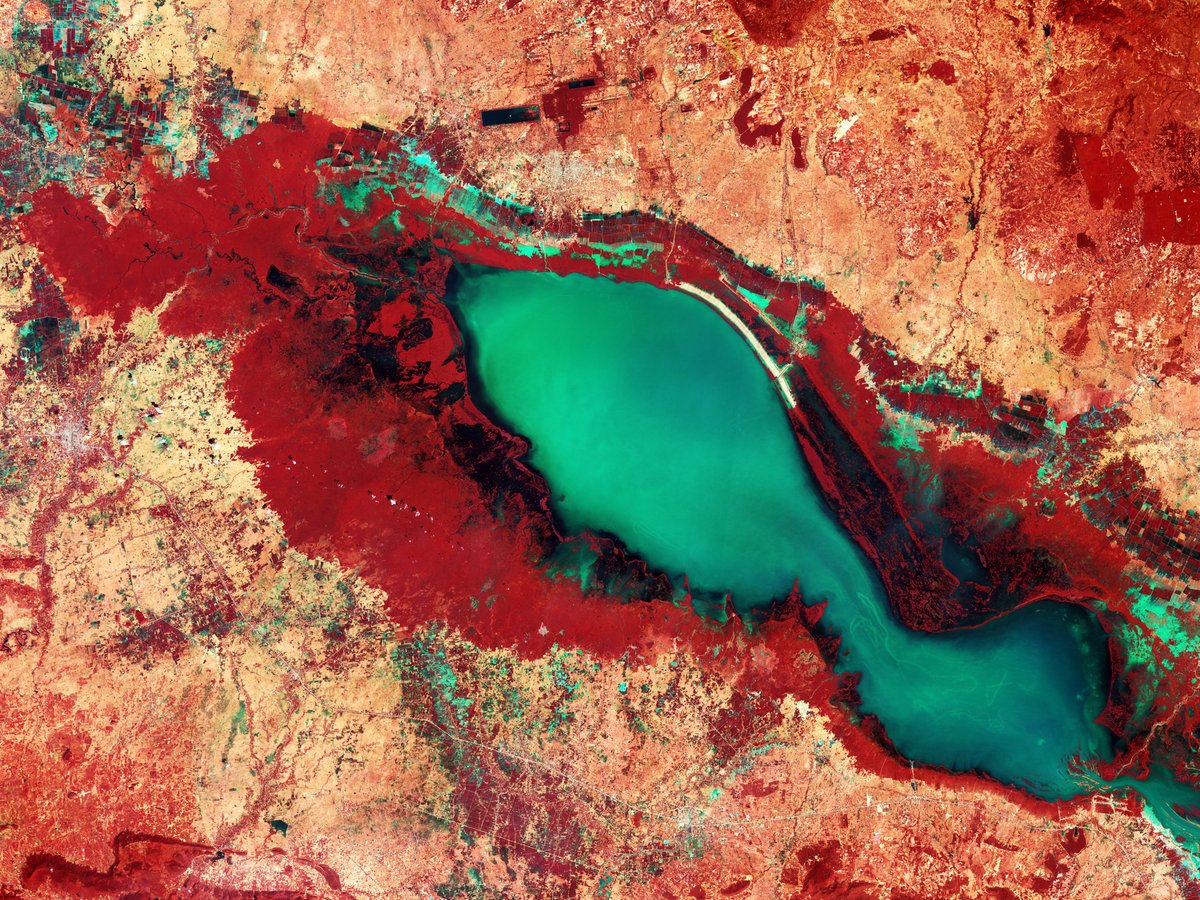
Our @ESA_EO Φ-lab has released, in partnership with @huggingface, the first dataset of 'MajorTOM', or the Terrestrial Observation Metaset, the largest community-oriented and machine-learning-ready collection of @CopernicusEU #Sentinel2 images ever published and covering over 50%
account_circle
European Space Agency(@esa) 's Twitter Profile Photo

Mars or Earth?

This image may resemble the surface of Mars, but it actually is stunning terrain of northwest Namibia.

Several significant geological features dominate this Copernicus EU image:

⛰️The Brandberg Massif, one of the highest granite mountain in Namibia.
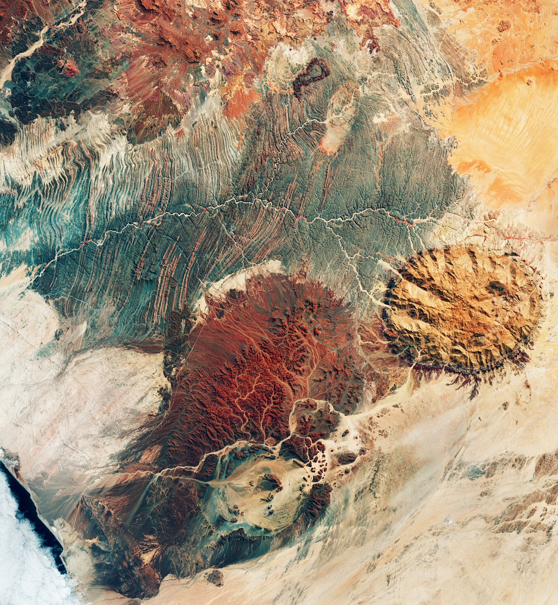
Mars or Earth? 

This image may resemble the surface of Mars, but it actually is stunning terrain of northwest Namibia.

Several significant geological features dominate this @CopernicusEU #Sentinel2 image:

⛰️The Brandberg Massif, one of the highest granite mountain in Namibia.
account_circle
Alejandro S. Méndez ⚒️(@asalmendez) 's Twitter Profile Photo

Antier el satélite sobrevoló el centro de y esta es la imagen que tomó del cráter del volcán .

Se puede ver un punto brillante en el cráter interno volcán, algo relativamente normal ya que como sabemos los últimos días este coloso a tenido

account_circle
Tutiempo(@tiempobrasero) 's Twitter Profile Photo

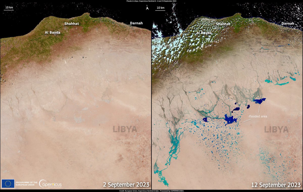
Donde había desierto ahora hay ríos y lagos... de un día para otro (eso es lo malo)

Imagen del satélite 🛰️ de Copernicus EU

Una es del 2 de sept
y la otra del 12 de sept tras el paso de la convertida en posible dejando miles de muertos

Donde había desierto ahora hay ríos y lagos... de un día para otro (eso es lo malo) 

Imagen del satélite 🛰️ #Sentinel2 de @CopernicusEU 

Una es del 2 de sept
y la otra del 12 de sept tras el paso de la #borrascaDaniel convertida en posible #medicane dejando miles de muertos
account_circle
European Space Agency(@esa) 's Twitter Profile Photo

📷 This week's features a Copernicus EU image of Alaska’s Columbia Glacier, one of the fastest changing glaciers in the world🧊

Since the early 1980s, the Columbia Glacier has retreated more than 20 km and lost about half of its total volume. This one
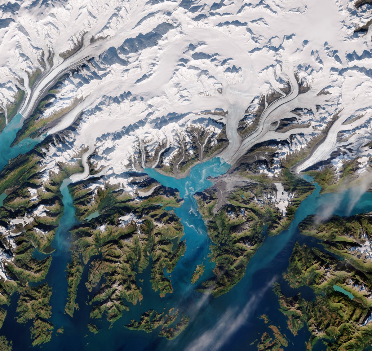
📷 This week's #EarthFromSpace features a @CopernicusEU #Sentinel2 image of Alaska’s Columbia Glacier, one of the fastest changing glaciers in the world🧊 

Since the early 1980s, the Columbia Glacier has retreated more than 20 km and lost about half of its total volume. This one
account_circle
European Space Agency(@esa) 's Twitter Profile Photo

Have we spotted the Millennium Falcon from space??

Not quite but we did spot Japan's newest island growing! 🌋

The image taken by Copernicus EU in November 2023 showed how the island had grown, due to activity of the underwater volcano.

📸 esa.int/.../2023/12/Vo…
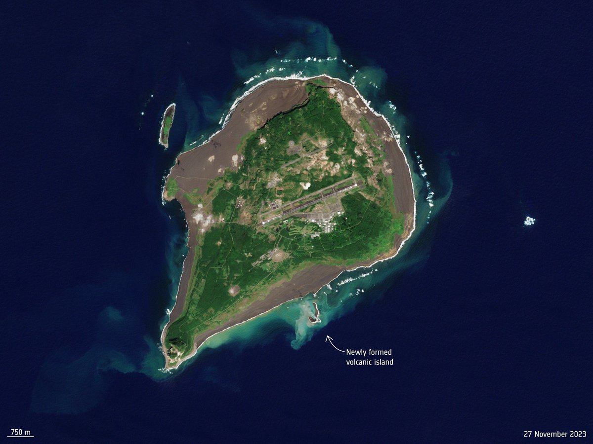
Have we spotted the Millennium Falcon from space??

Not quite but we did spot Japan's newest island growing! 🌋

The image taken by Copernicus EU #Sentinel2 in November 2023 showed how the island had grown, due to activity of the underwater volcano.

📸 esa.int/.../2023/12/Vo…
account_circle
ESA Earth Observation(@ESA_EO) 's Twitter Profile Photo

A Copernicus EU image of - captured yesterday 17 April.

It's a false colour composite which highlights flooded areas in turquoise.
Red patches in the image indicate vegetation.

Click on the link below to explore this image at its full 10 m resolution:
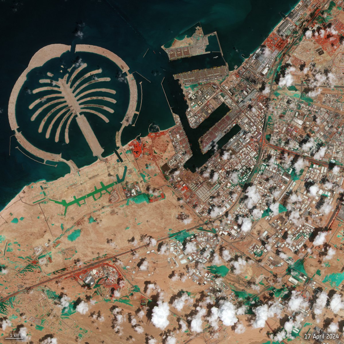
A @CopernicusEU #Sentinel2 image of #DubaiFlooding - captured yesterday 17 April.

It's a false colour composite which highlights flooded areas in turquoise. 
Red patches in the image indicate vegetation.

Click on the link below to explore this image at its full 10 m resolution:
account_circle
ESA France(@ESA_fr) 's Twitter Profile Photo

L'île de Rhodes🇬🇷 est touchée depuis une semaine par un incendie pour lequel le service de Gestion des Urgences Copernicus EMS a été activé.

📷Copernicus EU du 23/07. Les données du capteur SWIR ont été superposées pour mettre en évidence les points chauds.
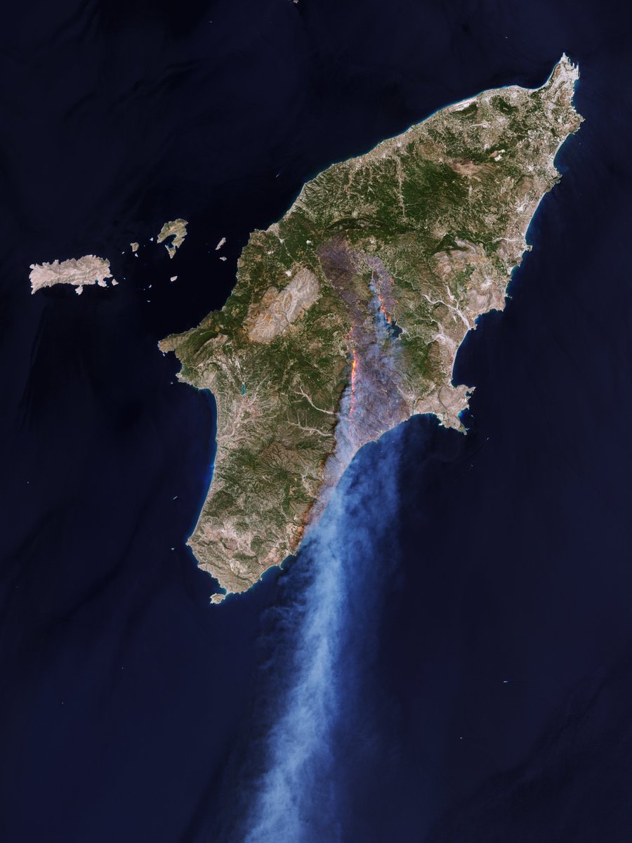
L'île de Rhodes🇬🇷 est touchée depuis une semaine par un incendie pour lequel le service de Gestion des Urgences @CopernicusEMS a été activé.

📷@CopernicusEU #Sentinel2 du 23/07. Les données du capteur SWIR ont été superposées pour mettre en évidence les points chauds.
account_circle
Rohan Fisher(@RohanFisher4) 's Twitter Profile Photo

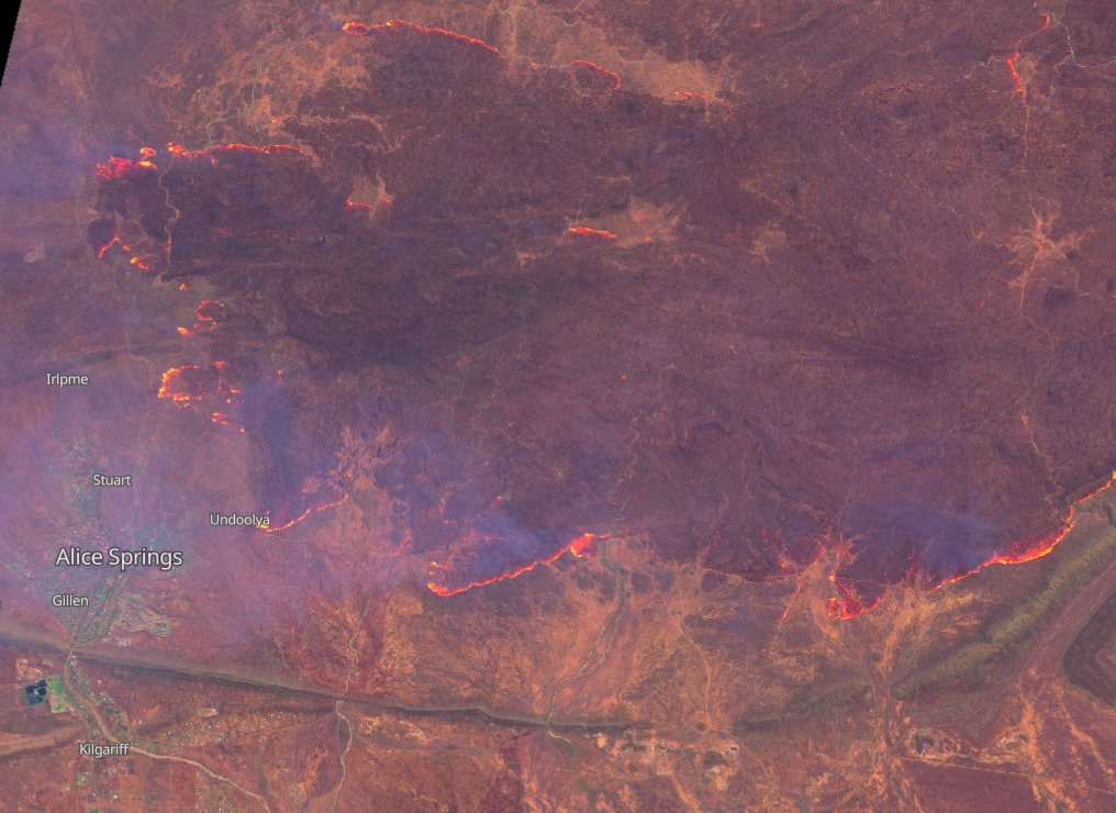
Alice Spings yesterday!!

We knew this season was going to be bad but this is scary! track these fires at firenorth.org
Sentinel2 image.
?

Alice Spings yesterday!! 

We knew this season was going to be bad but this is scary!   track these fires at firenorth.org
Sentinel2 image.
#buffel?
account_circle
SatWorld(@or_bit_eye) 's Twitter Profile Photo

🔴⚠️💧❄🇷🇺The rains and rapid melting in caused the worst of river in decades.Today it has reached its peak in where several districts have been evacuated. Here the 📸of today and one year ago

account_circle
European Space Agency(@esa) 's Twitter Profile Photo

📷 This week's takes us us over part of the Yukon Delta in the US state of Alaska.

The Copernicus EU image shows how the river branches off into numerous channels that meander through the low-lying terrain on their way to the sea and how much sediment
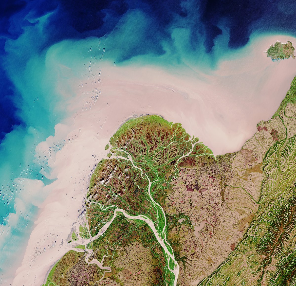
📷 This week's #EarthFromSpace takes us us over part of the Yukon Delta in the US state of Alaska.

The @CopernicusEU #Sentinel2 image shows how the river branches off into numerous channels that meander through the low-lying terrain on their way to the sea and how much sediment
account_circle
European Space Agency(@esa) 's Twitter Profile Photo

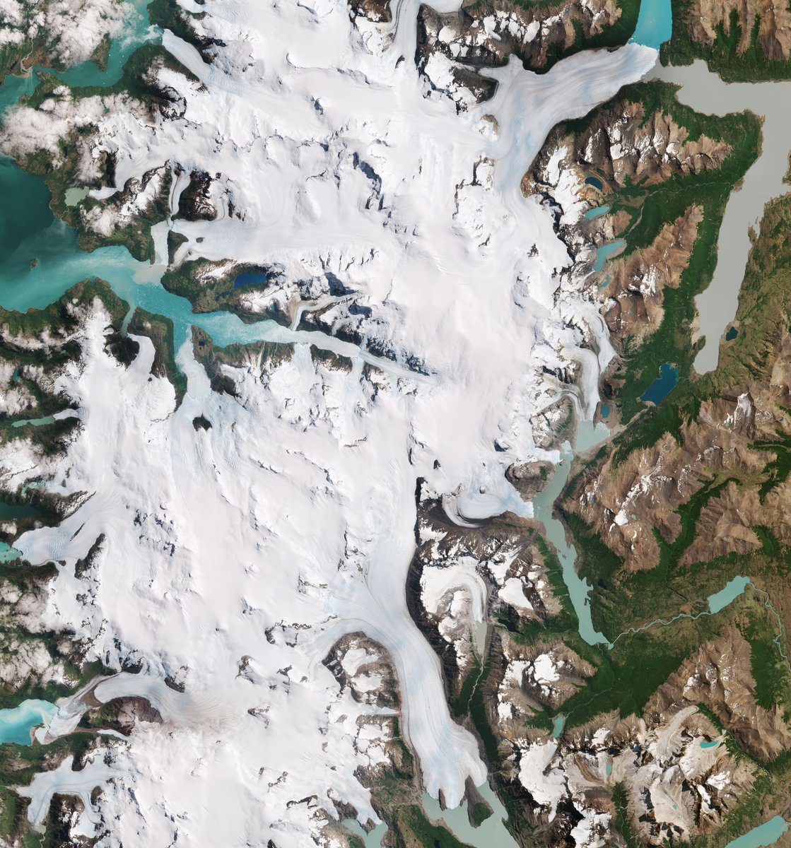
☃ Part of the Southern Patagonian Ice Field with its white glaciers and aquamarine lakes is featured in this Copernicus EU image.

Zoom in to explore this image at its full 10 m resolution here 👉 esa.int/ESA_Multimedia…

☃  Part of the Southern Patagonian Ice Field with its white glaciers and aquamarine lakes is featured in this @CopernicusEU #Sentinel2 image.

Zoom in to explore this image at its full 10 m resolution here 👉 esa.int/ESA_Multimedia…
account_circle
European Space Agency(@esa) 's Twitter Profile Photo

❄☃ 'We're dreaming of a white ...'

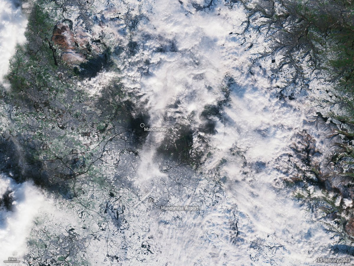
Today we take a look at some snow covered regions as seen from space, we start off with this Copernicus EU image of Manchester under snow from the beginning of the year.

👉 esa.int/ESA_Multimedia…

❄☃ 'We're dreaming of a white #Christmas...'
 
Today we take a look at some snow covered regions as seen from space, we start off with this @CopernicusEU #Sentinel2 image of Manchester under snow from the beginning of the year.
 
👉 esa.int/ESA_Multimedia…
account_circle
European Space Agency(@esa) 's Twitter Profile Photo

📷 This week's Earth from space features the ice tongue of the Dawson-Lambton Glacier in Antarctica.

The Copernicus EU image features patterns on and around the glacier which depict crevasses and rumples, resulting from pressure as the glacier slides towards the sea.
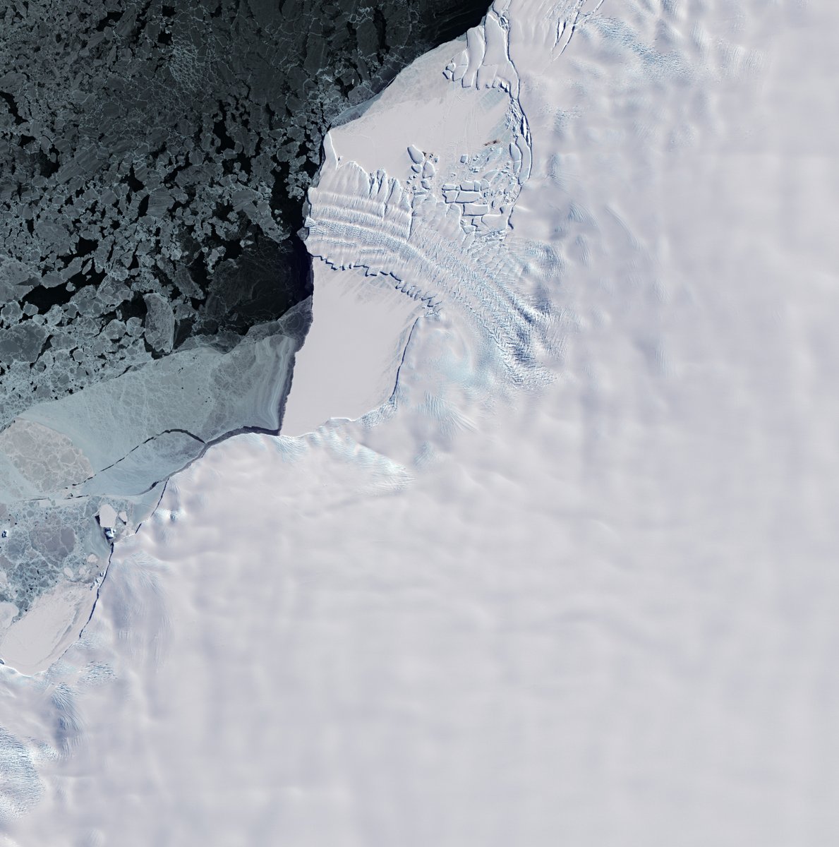
📷 This week's Earth from space features the ice tongue of the Dawson-Lambton Glacier in Antarctica.

The @CopernicusEU #Sentinel2 image features patterns on and around the glacier which depict crevasses and rumples, resulting from pressure as the glacier slides towards the sea.
account_circle
European Space Agency(@esa) 's Twitter Profile Photo

❄ Making for a dreamy postcard, this Copernicus EU image showcases the Liverpool Land peninsula, on the east coast of Greenland.

In the dark blue waters of the Greenland Sea, a swirl of sea ice stands out clearly in white.

👉 esa.int/ESA_Multimedia…
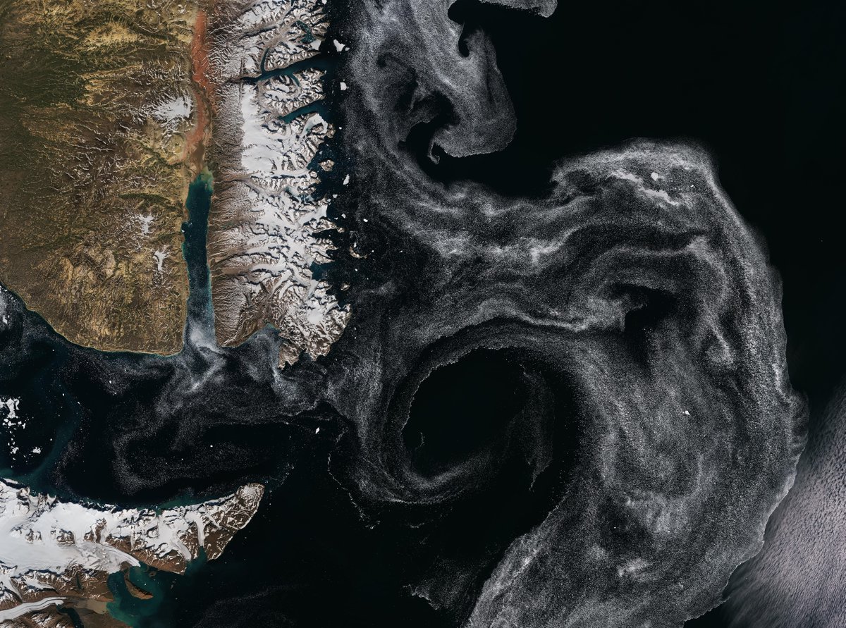
❄ Making for a dreamy postcard, this @CopernicusEU #Sentinel2 image showcases the Liverpool Land peninsula, on the east coast of Greenland.

In the dark blue waters of the Greenland Sea, a swirl of sea ice stands out clearly in white.

👉 esa.int/ESA_Multimedia…
account_circle